September 24, 2026
New Features
See What to Improve on Your Map with the New Dashboard (Early Access)
The new Dashboard in the CMS gives your team one place to keep an eye on your map.
- Recommendations: See which locations need attention, such as missing descriptions, photos, or outdated details. Each recommendation explains what to fix and links straight to the affected locations, so you don't have to audit the map by hand.
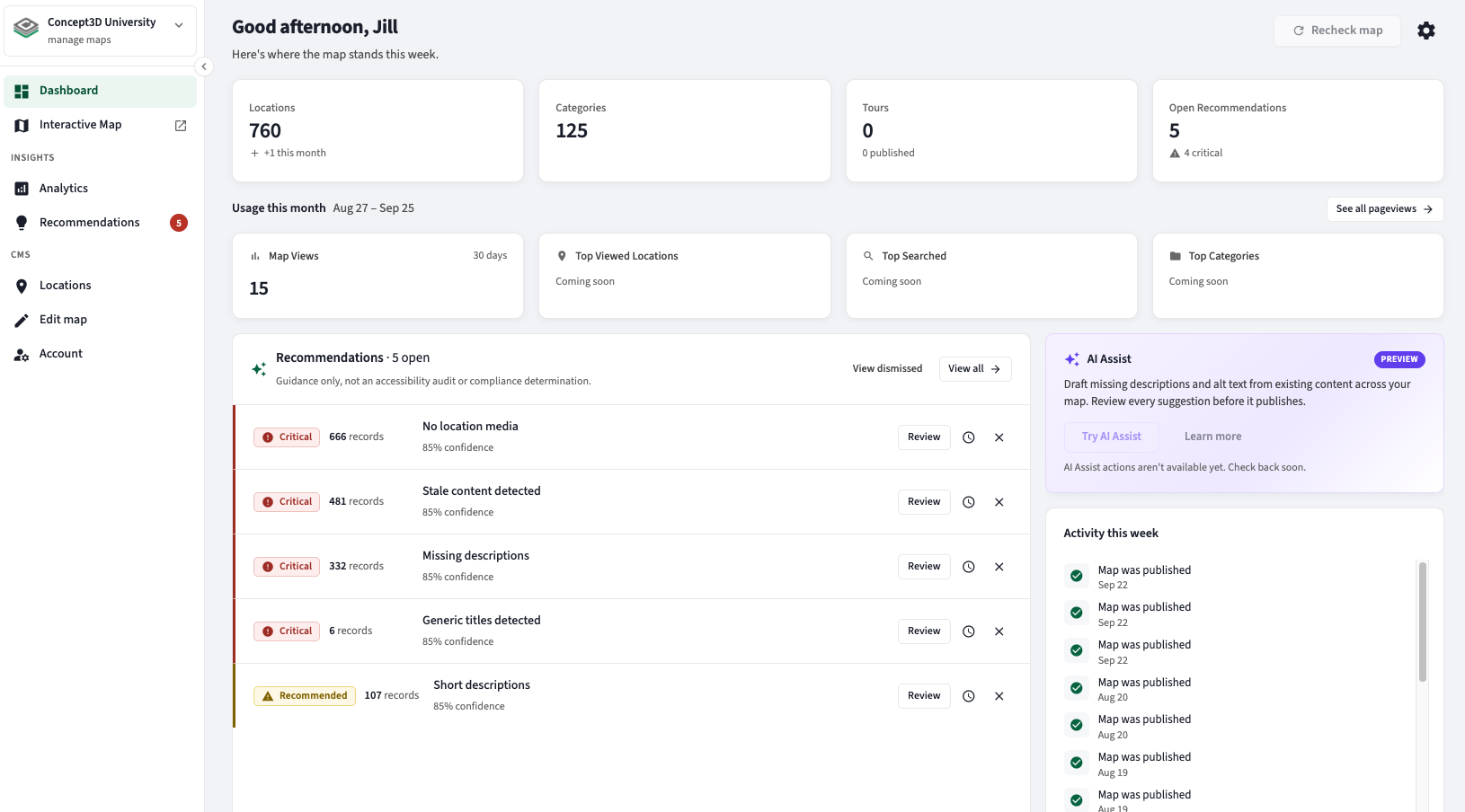
- Pageviews in Analytics: See how many times your map has been viewed, as a trend over time or broken down by day or month, and export the numbers to CSV. Concept3D counts the views, so you don't need Google Analytics set up to see them and no need to worry about users who reject cookies.
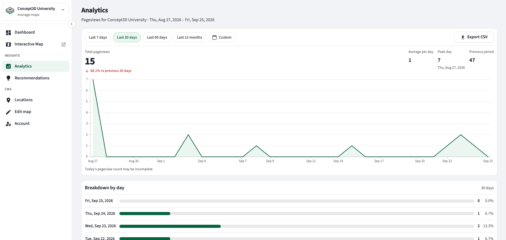
The Dashboard is available now as Early Access. Ask your Partner Success manager to turn it on for your map. We plan to turn it on for all maps in Q4, and feedback from Early Access maps will help shape future updates.
More information on the new CMS Dashboard can be found in this help article.
Feature Enhancements
Get Directions by Typing a Location Name
Visitors can now type a building, lot, or venue name into Directions and get a route without picking from the suggestions. When they press Enter or Get Directions, the map finds the best match among your locations and fills in its official name. For example, typing "120" at a stadium becomes "Section 120" before the route is drawn.
- Suggestions: The first suggestion is highlighted as you type, and Enter selects it.
- Nearby results only: A name that doesn't match one of your locations only resolves to an address near your map, so a campus building name no longer routes to another city.
- Clearer error: When a name can't be found, visitors see "We couldn't find that location. Choose from the suggestions or try another name." instead of a routing error.
Concept3D Managed Categories
Categories used for map revisions, managed updates, and archives are now identified as Concept3D Managed in the CMS, helping keep your Dashboard focused on the content your team maintains.
- Managed categories and their subcategories are excluded from Dashboard counts, and their locations are excluded from content recommendations and bulk editing by default
- You can continue adding locations to revision categories to request changes
- This designation does not change what visitors can see. Existing visibility and privacy settings still apply
September 11, 2026
New Features
Show Direction with Polyline Arrows
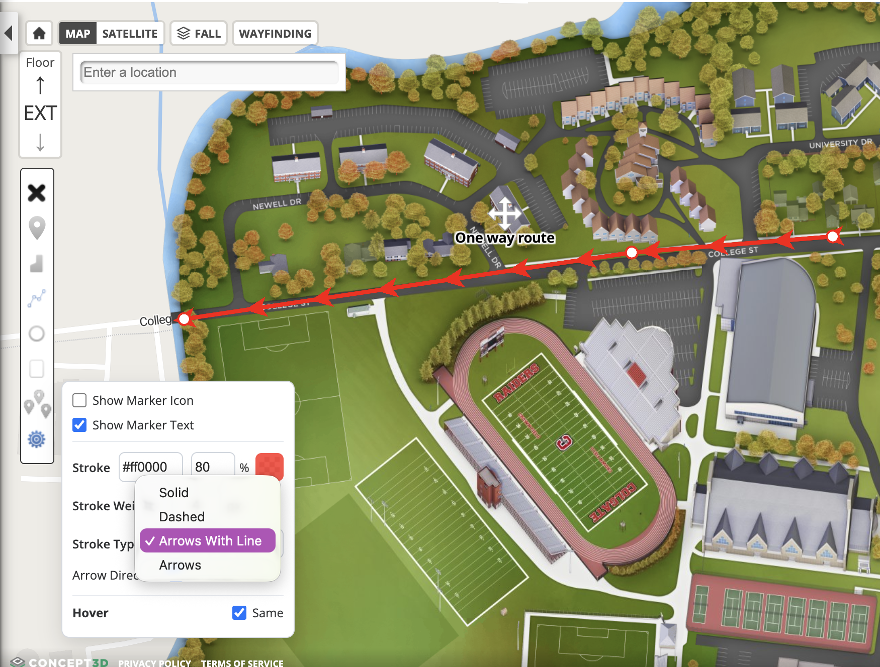
CMS users can now add directional arrows to polylines, including arrows at one or both endpoints and repeated arrows along a path. Visitors can more easily understand travel direction on routes and other linear map features.
- Stroke Type now includes Arrows With Line (chevrons on a connecting line) and Arrows (chevrons only).
- On solid or dashed polylines, Endpoint Arrow can add a head at the start, end, or both ends.
- Reverse flips arrow direction. Arrows use the line’s Stroke color.
- Arrows also work on polygon/circle/rectangle outlines in the style panel.
New Google Map Region Setting
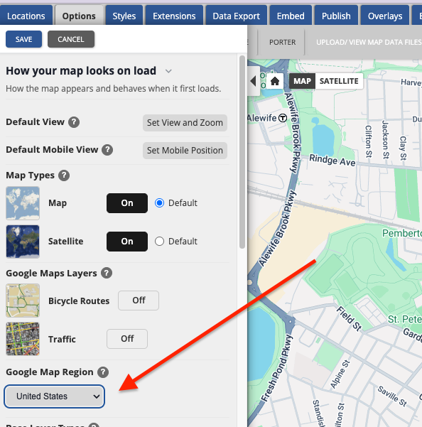
Maps on the Google base map can now set a Google Map Region in the Options tab. Choosing Canada biases map data (tiles, geocoding, and places search).
- United States is the default and applies to all existing maps, so nothing changes unless you choose Canada.
- Action required: If your Google map should use Canadian data, set this to Canada, then save, publish, and fully reload the map.
Feature Enhancements
Add Keywords and Tags as Chips
The Labels data field on locations and categories is now called Tags. This is the free-text internal only field used to group locations for filtering and Bulk Edit in Location Manager. It is not related to the text labels that display on the map, which are unchanged. The new name appears in the location and category editors, filters, Bulk Edit, and CSV export, and stored values are unchanged.
- CSV import still accepts a Tags or Labels column.
- APIs return both tags and labels. Existing labels and ?label= calls still work; tags and ?tag= is the name going forward.
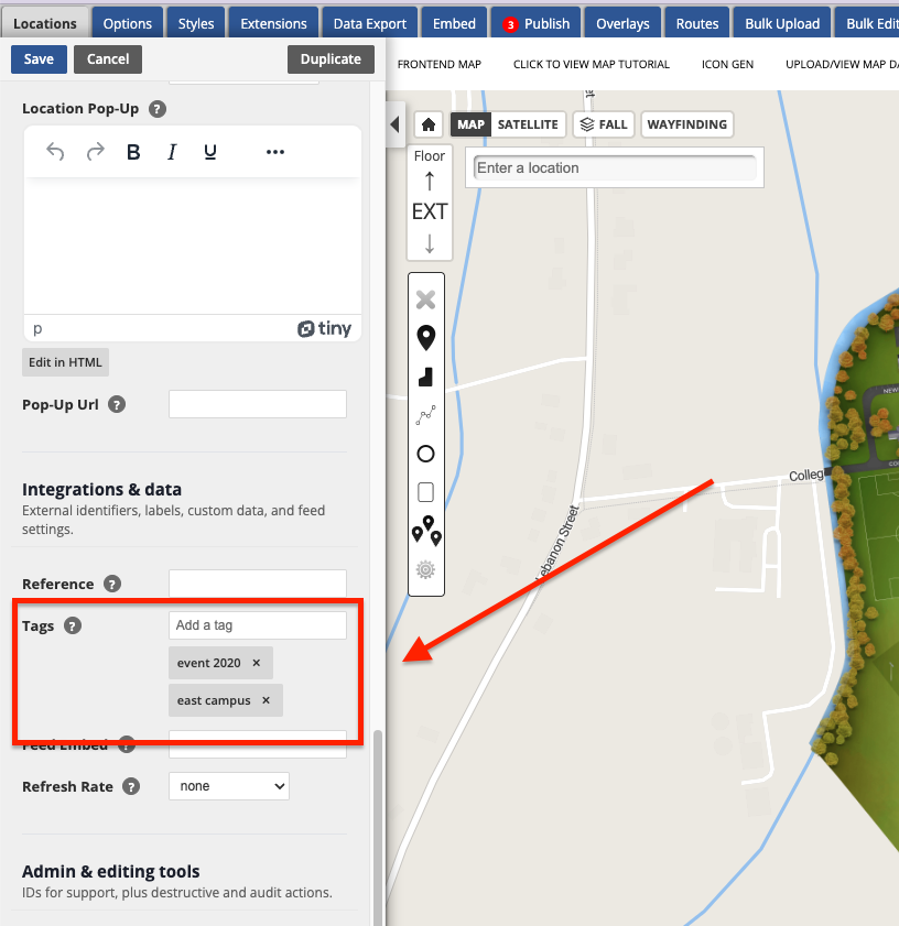
Keywords and Tags are also now chip inputs in both editors, matching Bulk Edit. Type a term and press Enter or comma to add it, click the × to remove one, or paste a comma-separated list to add several at once. Duplicates are ignored regardless of capitalization, multi-word terms like "Music Hall" stay as one chip, and a term you typed but did not press Enter on is still saved when you click Save.
Find the Fields You Use First in the Location and Category Editors
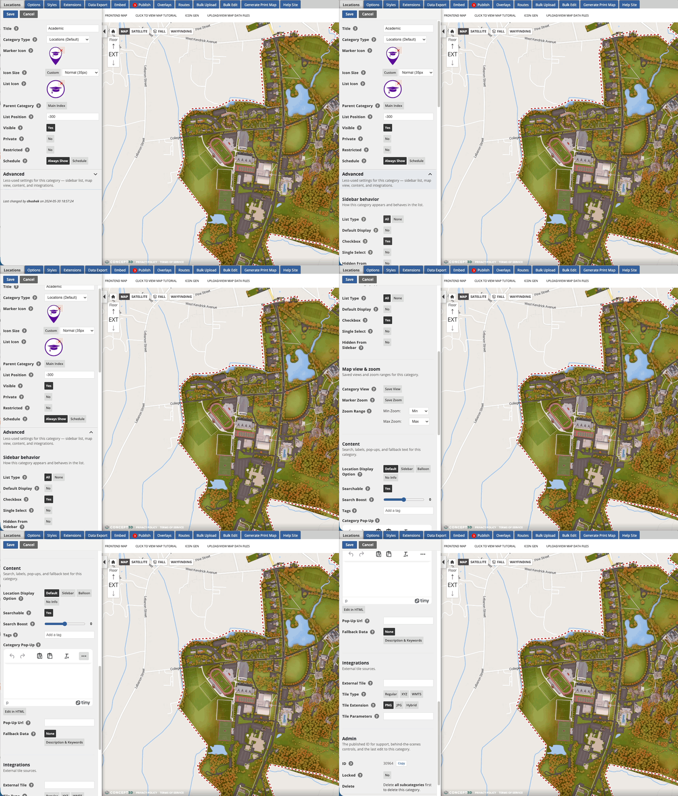
The Location and Category editors now show the fields most editors touch every day at the top, with everything else under an Advanced disclosure. Nothing has been removed, and expanding or collapsing Advanced never changes your values. Advanced opens collapsed each time you open an editor.
See What Changed Before You Publish
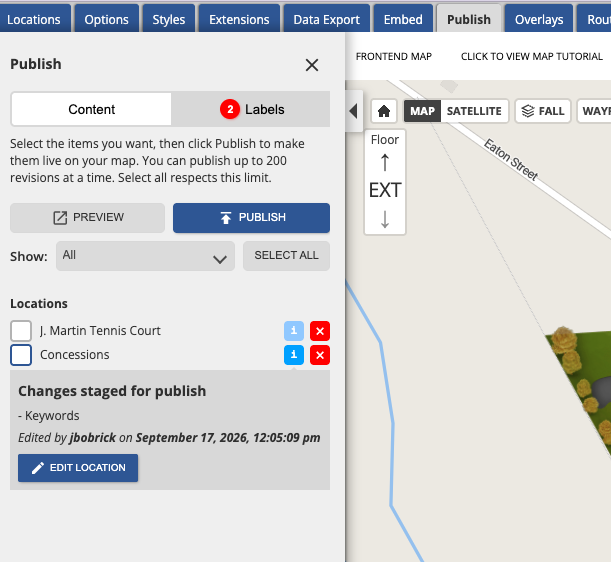
In the Publish queue, the info popover lists the fields staged for that item and offers Edit location, Edit category, Edit tour, or Edit options so you can jump straight to the right editor.
You can also dismiss the Publish reminder balloon with X. It stays gone for the rest of that CMS page load, and auto-hide is a fixed few seconds so it no longer sits on top of Edit.
Additional Improvements
Two updates for maps with Strict Search turned on in Options:
- Multi-word keywords now match. A keyword like "student center" previously matched only when split into separate "student" and "center" keywords. Phrase keywords now match the way titles do, and unrelated titles that share one word still stay out of results.
- Help text corrected. The tooltip now accurately says Strict Search matches whole words in titles and keywords only, with no description or category matching, and that Weights do not apply while Search Boost does. Search behavior is otherwise unchanged.
Location Manager page size up to 500. Options are now 50, 100, 250, and 500, so large interior and campus projects can select and bulk edit a full set from one page. Your chosen page size is remembered when you return to the list, and Select All still selects only the current page.
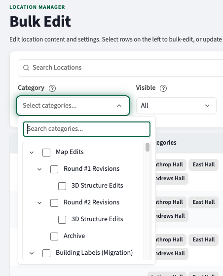
Location Manager Category filter shows hierarchy. Parent categories and subcategories appear as an indented, expandable list with a checkbox beside each, instead of a flat list of names. Select several in one pass; selections still combine as before and stay visible as removable chips under the filter bar.
August 6, 2026
Feature Enhancements
Search result prioritization: Control How the Map Ranks Results
Previously, Admins could not influence search relevance. Relevance was fixed on every map, so a campus with long location descriptions got the same ordering logic as a stadium with short ones, and the only real lever was getting creative with keywords or rewriting content until the right thing surfaced. These two new controls change that.
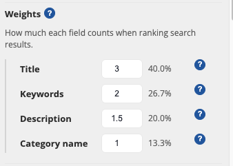
Search Weights is a new setting option under Finding places in Map Options page. It sets how much each searched field counts.
- Four fields influence search results: Title, Keywords, Description, and Category Name
- Each field is now adjustable from 0 to 10
- A live readout shows each field's share of the total, so the balance is visible before saving.
- Setting a field to Excluded removes it from search entirely, which is the quickest fix for maps where long descriptions bury the locations people are actually looking for.
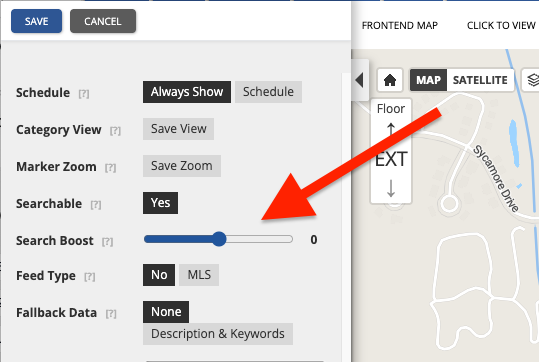
Search Boost is a new option on the category edit page. It allows you to influence all locations in an entire category, positively or negatively in search results.
- Each individual category can be boosted from -3 to 3. Positive numbers increase where the locations sort in search results, and negative numbers decrease.
- Keeping the boost at 0 means it is not impacting the search results.
- For example, Dining can sit near the top of results no matter how each individual location is worded, and a Maintenance category can fall below everything else without being hidden from the map.
- Boost applies only to locations assigned directly to that category, so it does not cascade into sub-categories.
Defaults match how search has always ranked results, so nothing changes until they are adjusted, and preview mode shows the effect before publishing. For the default weights, how the two controls interact, and guidance on tuning, see Map Search: Understanding & Adjusting Results
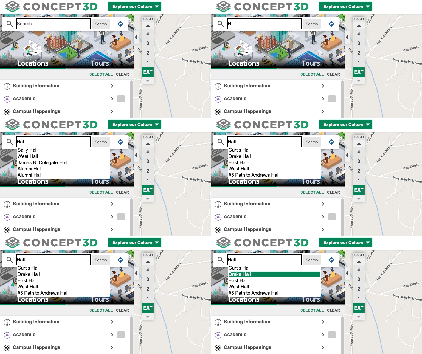
Search autocomplete also feel steadier. The search bar waits for a brief pause in typing, holds off until at least two characters have been entered, and no longer lets a late response from an earlier keystroke overwrite newer results. Autocomplete results return faster too, since each request skips preparing image data the list never displays. Pressing Enter or the search button still searches immediately.
Map Options Panel Rebuilt for Clarity
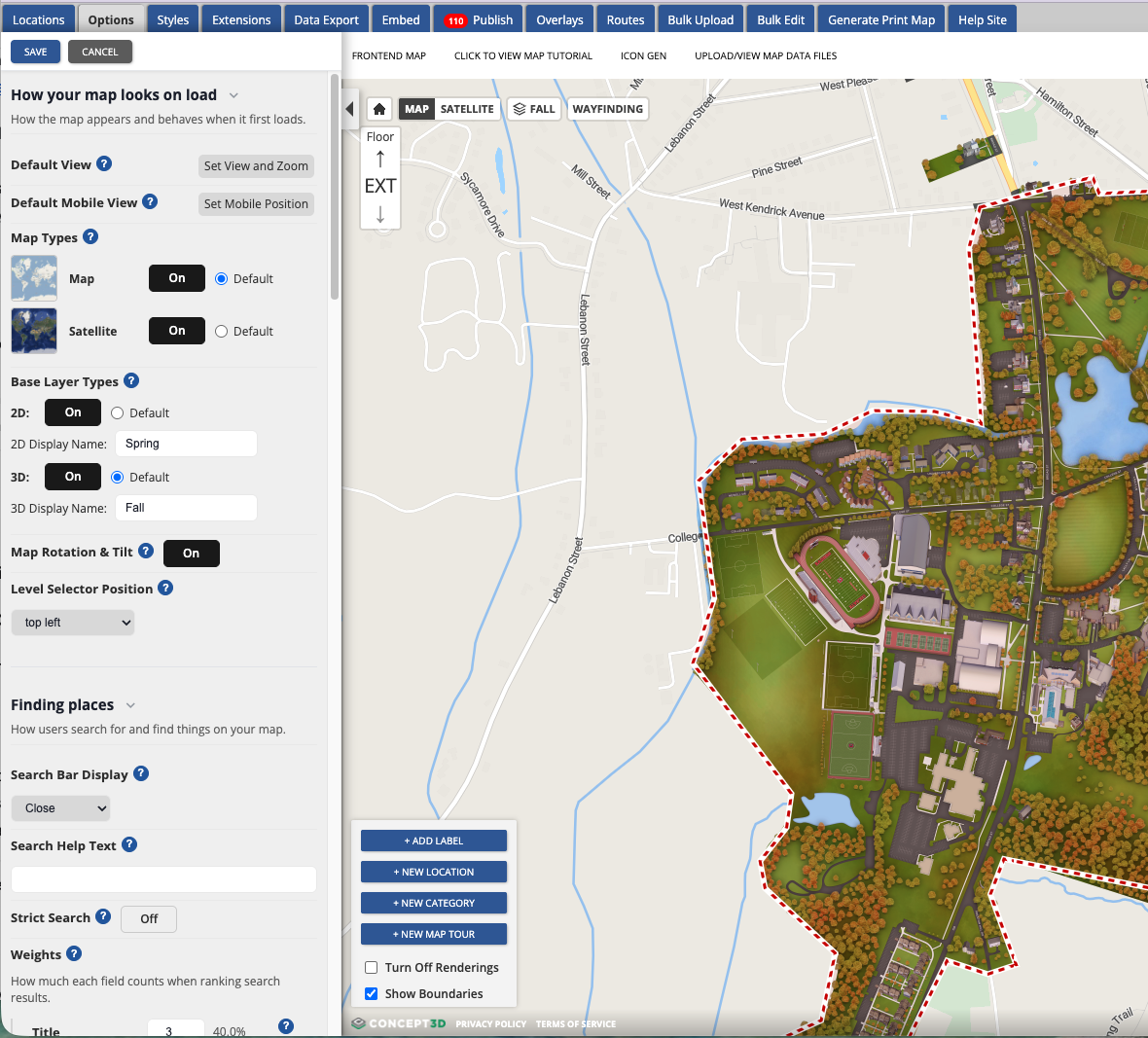
The Map Options panel was long, mixed advanced settings in with everyday ones, and used labels that did not always describe what the setting did. It is now organized into collapsible sections grouped by what an admin is trying to accomplish: how the map looks on load, finding places, what happens when a visitor opens a location, and sidebar and branding. Settings that depend on another setting are nested beneath the one that controls them, and help tooltips explain the settings that generate the most questions.
A few labels changed along the way:
- Multiple Orientations is now Map Rotation & Tilt.
- Location Info Display is now Location Details Display
Line Breaks in Marker Text
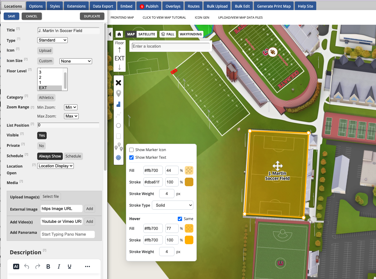
Long text location names could run over other map content with no way to wrap them. Adding \n to a location name now breaks the marker text across lines on the map, the same pattern already used for dynamic labels. Everywhere a single-line name is the right thing to show, it stays single-line: the category tree, the location balloon, and the sidebar all collapse the break to a space. In the CMS, the location edit title and the category tree display the literal \n so the name stays searchable and easy to find and understand while editing.
Terrain in the CMS Editor Map
Maps with Terrain enabled in Map Manager now render terrain in the CMS editor map, so what an admin sees while placing and editing content matches the elevation of the real site. Terrain stays on when switching into 360° view, with model alignment and camera position accounting for elevation. Satellite view intentionally renders without terrain, and switching back to Map view restores it. Terrain on the published map is not part of this change.
Data Export Field Names Now Match Bulk Upload
The data page and CSV export used Name and Categories while the bulk uploader expects Title and Category, which meant an export could not be re-imported without editing the headers first. Both now use Title and Category, so a data export can go straight back into the bulk uploader.
Bulk Upload to Invisible Categories
Bulk uploads of both locations and dynamic labels failed with a "Parent Category not found" error when the target category was set to invisible, forcing admins to flip the category to private, upload, and flip it back. Invisible categories are now recognized.
New sidebar Display for Parts of Accounts & the CMS
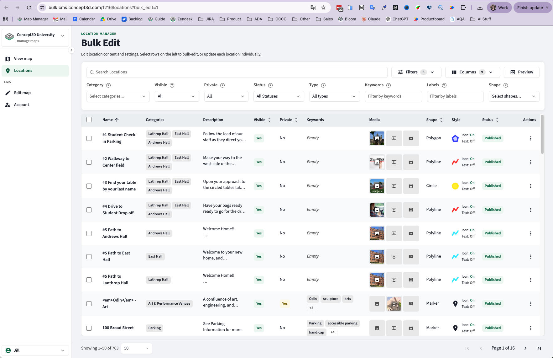
Bulk edit is the first part of the CMS to take on a new sidebar layout. The sidebar carries quick links back to the CMS and out to the live map, so checking an edit in context no longer means keeping extra tabs open or retyping a map URL. How bulk edit works has not changed, only where it lives and how it looks. This is the start of a broader refresh rather than a one-time change, so more of the CMS will move to this sidebar and visual style over the coming releases, and each area will be called out here as it moves.
July 23, 2026
Feature Enhancements
Wayfinding through buildings with Restricted Interiors
Campuses that keep interior floor plans private can now let accessible routes pass through a building without revealing what is inside.
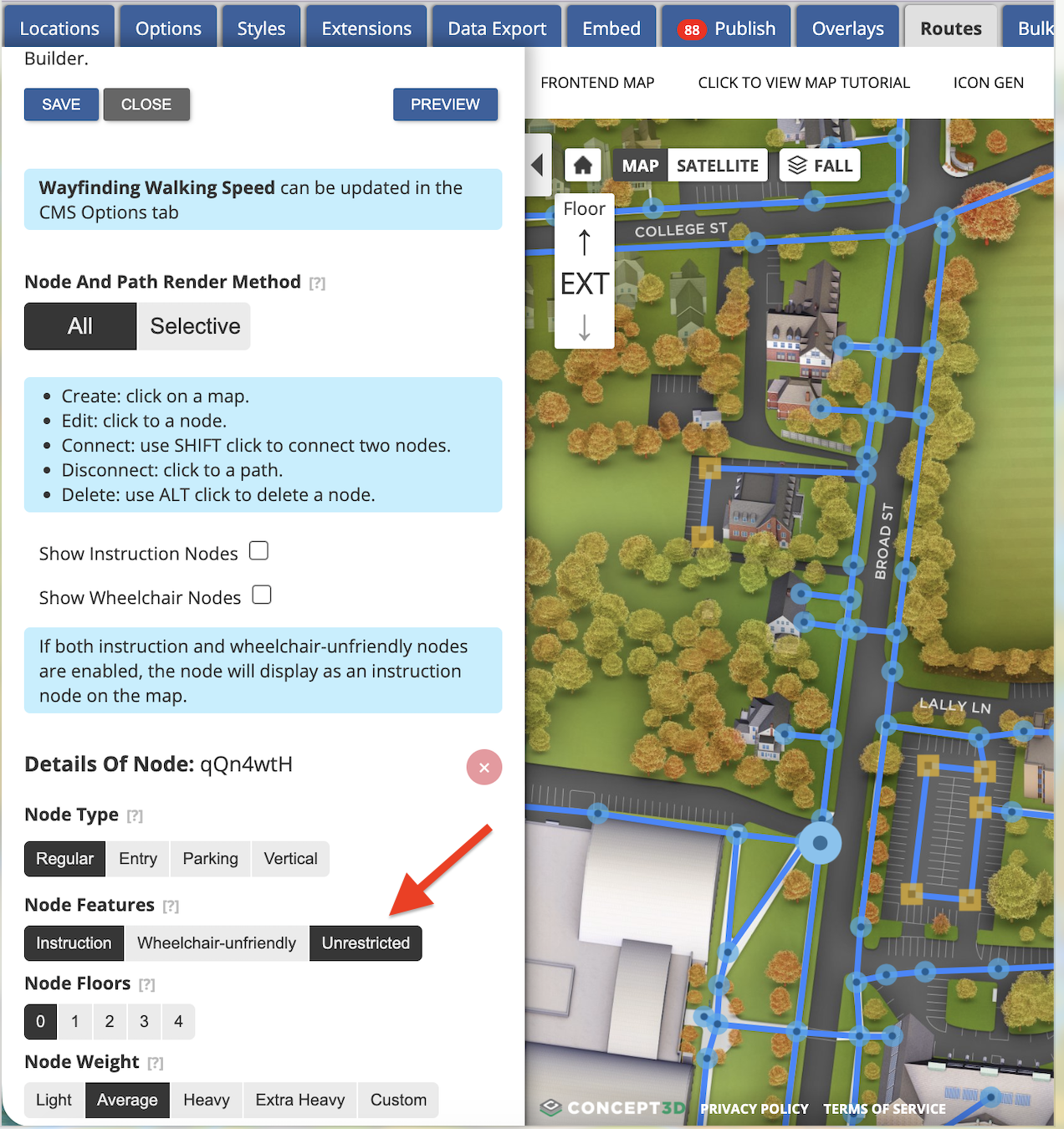
- Editors can mark individual interior wayfinding nodes as Unrestricted in Route Builder rusliting in anonymous visitors receiving a route that follows the building footprint on the exterior view.
- For Restricted Interior Maps, every interior node (existing and new) defaults to restricted. So it this requires a manual override to expose.
- Nothing changes on maps that do not restrict interiors.
Zoom level Readout
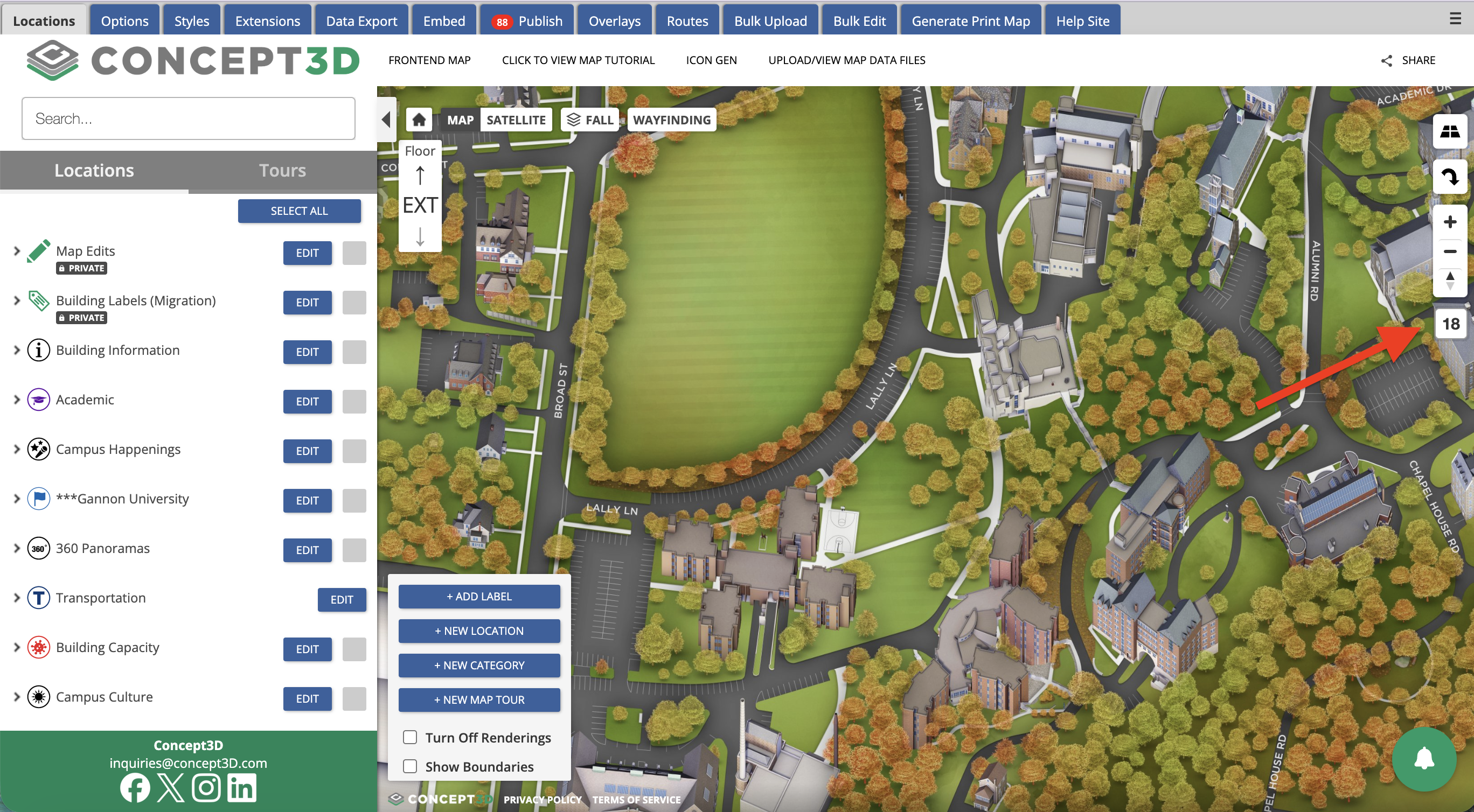
Setting minimum and maximum zoom no longer takes trial and error. A small readout beneath the zoom controls shows the map's current zoom level using the same numbering as the Min Zoom and Max Zoom dropdowns. It is always visible in the CMS and can be turned on for the front end visitor map by adding &showZoom to the URL. This is a display only, not a saved setting.
Example front end URL: http://map.concept3d.com/?id=1216&showZoom
Static Map Marker Text
Static map images now render marker text to match the interactive map. When a location has Show marker text enabled, the text appears with the same font, color, and placement it has on the live map, including text-only locations with no icon or shape.
Example Static Map: https://staticmap.concept3d.com/map/static-map/?map=1216&loc=645828&scale=1&zoom=17
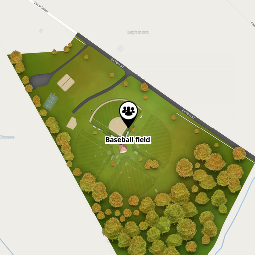
Terrain for 360º Maps
Campuses are not flat, and now your map does not have to be either. Terrain brings real elevation to 360º Maps, so hillsides, valleys, and grade changes render as the three dimensional surface they actually are. For institutions built into a slope, this is the difference between a map that looks like a diagram and one that looks like the place students walk every day.
Terrain can be enabled per map by the Concept3D team. Once it is on, elevation renders automatically for every visitor with nothing for them to turn on or find.
- Elevation renders automatically for all visitors, with no toggle or extra step.
- Models placed on your 360º map are built against the same terrain surface visitors see, so placement, alignment, and lighting stay true.
- If elevation tiles are slow or unavailable, the map falls back to its standard rendering rather than failing to load.
Reach out to your Partner Success Manager to turn Terrain on for your map.
July 8, 2026
Feature Enhancements
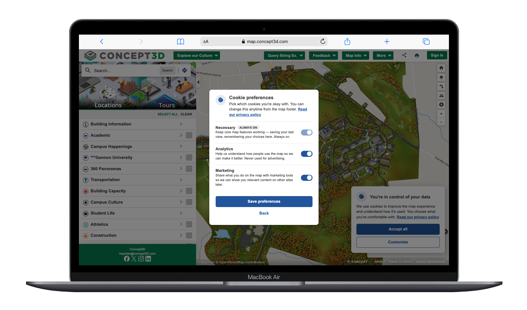
Cookie Consent Controls
Map visitors are now in control of their cookies. The previous accept-only cookie banner has been replaced with a compact consent card, and the full map experience works no matter what a visitor chooses.
- Visitors can accept all cookies or choose Customize to open a Preferences modal where Analytics and Marketing cookies can be enabled or disabled individually; Necessary cookies remain always on.
- Non-essential cookies no longer load before a visitor gives consent, supporting GDPR-compliant consent for maps with European audiences.
- Visitors can update their choice at any time through the Cookies link in the map attributions.
- The consent card meets WCAG 2.2 AA accessibility standards, and maps configured to suppress the cookie prompt continue to work as before.
Usability Updates
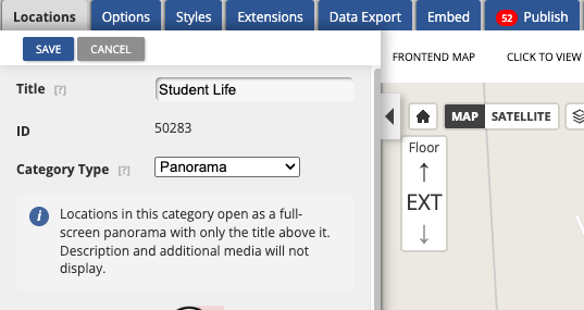
- Selecting the Panorama or Dynamic Label category type in the CMS now displays an inline description of how locations or labels in that category will behave on the published map.
- Clicking Add Label in the CMS now places the cursor directly in the name field, matching the New Location behavior.
- Map style images such as logos, balloon icons, sidebar images, and favicons are now automatically resized on upload to fit their display areas, preventing oversized images from breaking the map layout.