February 2, 2021 : Map Release
New Features
Update Inactive Maps’ “Cannot Access” Landing Page
- Occasionally, old end users try to access maps that are no longer active and available and were met with a very plain, text-only landing page. This landing page has since been updated to follow suit with Concept3D’s branding.
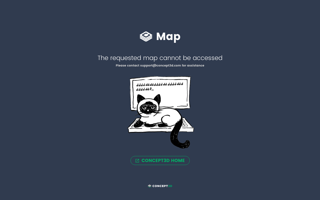
The new “cannot access” screen users will land on if they attempt to access an inactive map.
(ADA) Logical Navigation of Google Map Controls and Links
- When navigating Interactive Maps with a keyboard, actionable elements like buttons should be navigated left-to-right, top-to-bottom. This has been true of OSM and MapboxGL maps but not of Google Maps. When keyboard users would enter the map region, filled with map controls and links to Terms of Service and Privacy, the order jumped all over the place: bottom-left, top-right, bottom-right, etc. While there are still some limitations that prevent matching the exact flow as OSM, this has been updated and Interactive Maps using Google are able to be navigated more logically now.
(ADA) Increase Readability of Keyboard Shortcut Menu
- Keyboard and screen reader users have had access to a “short menu” when they begin navigating Interactive Maps. This menu has been made more readable for screen reader users. They’re notified that they’re in a “skip link region”, which describes each link in the short menu as a “same page link” so users know they’re shortcuts rather than links to an external site. The one exception to this is the Text Only Map link, which now has an icon attached. The Text Only Map link both visually and audibly lets users know they will be leaving the Map.
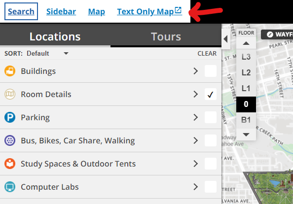
The shortcut menu keyboard users access when they begin tabbing through an Interactive Map.
February 17, 2021 : Map Release
New Features
Search server migration to Amazon CloudSearch
- Concept3D's search functionality had some major improvements! To understand all the updates and what changes you will see with your map, please refer to the detailed Search Engine information here.
February 18-26, 2021 : Map Release
New Features
(ADA) Read the Map Name when Screen Reader Focuses on Logo
- Having a well-organized HTML backbone for Interactive Maps helps screen reader users navigate more logically and efficiently. Part of having this HTML backbone well organized is to have correctly ordered headings and descriptive headings. “Logo” has been dropped and just the map name is used for the heading. We likely will add “map” at the end in the future, but first wanted to address all maps and then find a solution for map names with “map” in them next.
(ADA) High Contrast Styling for Wayfinding
- While thin, light designs are the hot trend in the web world, they’re rather inaccessible experiences for users with low vision. It is hard to decipher thin and light elements, especially when they have a light background behind them. Per Web Content Accessibility Guidelines, a minimum contrast ratio of 4.5 to 1 is recommended to ensure all components are legible, and all components of Wayfinding have been updated such that they fulfill this requirement.
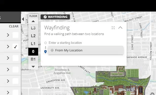
The clear locations button in Wayfinding only appears when there is location information inputted now.
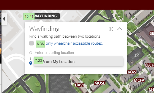
The new contrast ratios of elements in the Wayfinding module.
New Data Uploader Button in CMS
- There is now a new, standard link all clients can use to upload their reference data to Concept3D’s Google Drive.
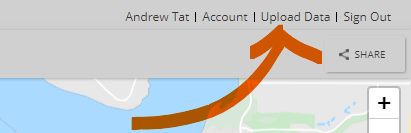
CMS users can now access the Data Uploader directly from their CMS.
(ADA) Sidebar Tabs Move Screen Reader Focus to Content Immediately
- The tabs in the sidebar give users quick access to the three major types of location info on the map. However, these tabs were incorrectly setup and keyboard users could get lost in the tabs before finding the content they were looking for. Now, when a keyboard user clicks on one of the tabs, they are immediately taken to the content of the tab itself. For example, if a user clicks on Tours, their keyboard focus is immediately moved to the first tour in the list (versus having to navigate past the Transit tab before reaching their content).
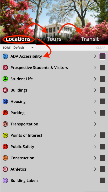
Focus jumps directly to the content if one of the Locations, Tours, or Transit tabs is pressed.
Other Updates
Various Feed Updates
March 18, 2021 : Map Release
New Features
Print Map
Print Map received a major, new 3.0 update that enables front end Interactive Map users to generate print maps in four main orientations: north, south, east, west. Other enhancements this update includes are:
-
Updated compass icon design
-
Ability to turn compass display on or off in the generated print map
-
New, stylized numbered icons that are used by default
-
Ability to use location markers’ icons instead if desired
-
Updated template and legend design to make print maps more readable with more than 99 markers
All maps are able to take advantage of Print Map 3.0.
Important Prerequisites
The CMS’s Generate Print Map functionality will not work with Print Map 3.0 at this time. An update to this is coming soon.
Additionally, since these printable orientations require the map to be spinnable, only maps on MapboxGL will fully take advantage of Print Map 3.0. Clients using Google Maps and OSM are indeed able to still take advantage of Print Map 3.0, but they will be limited to the north-up orientation.
No matter the map type, Print Map 3.0 generates print maps using only Concept3D tiles.
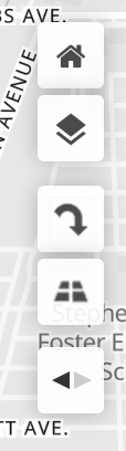
The middle rotate button is what allows users to rotate their Print Map. This button is only available on MapboxGL maps.
Print Map Editor
The layout and restrictions of the Print Map 3.0 editor are almost identical to older Print Map editors with a few notable exceptions:
-
Users can now disable the display of the compass on the generated print map
-
Users can no longer select which type of legend colors their print map has
-
The loading notification for users, while a print map is generating, includes current status

The Print Map 3.0 editor is very similar to the old Print Map editor but now allows users to rotate the map to their desired orientation.
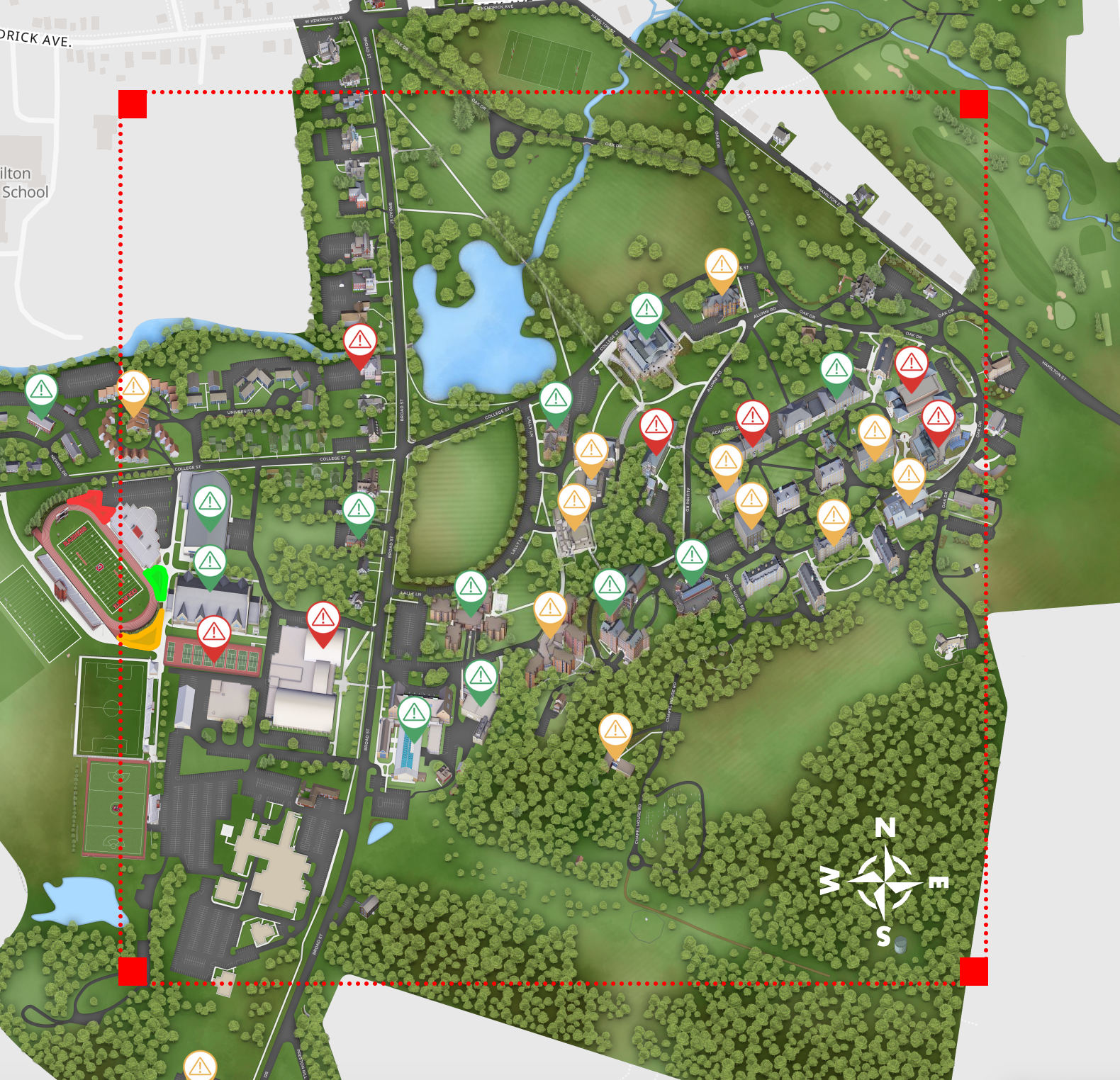
The red, selection box now matches the expected size of the generated print map. It also includes a new, reference compass in the bottom-right corner for users to know which way is north.
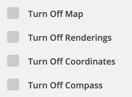
“Turn Off Compass” is a new option in Print Map 3.0 that disables the previously mentioned compass.
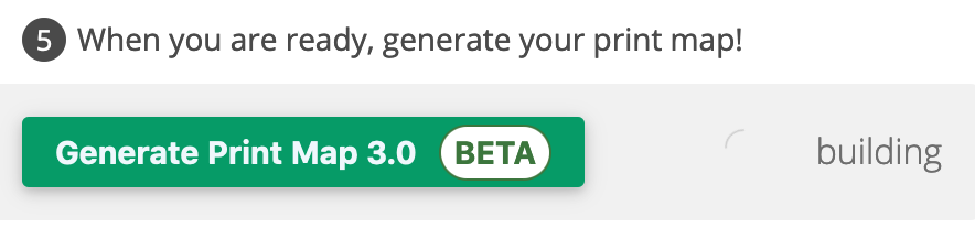
The new Print Map 3.0 button also includes clearer status updates on how far along the print map generation is.
Generated Print Map
The print map that is generated by Print Map 3.0 has a new layout that aims to make finding locations easier for end users. The layout is similar to older print maps with a few improvements:
-
The title, if given, now is displayed in the top-right corner underneath the client logo.
-
The legend has alternating background colors to assist with readability. It also overflows into multiple columns on the second page rather than a single column on the right side.
-
The grid that surrounds the map and guides users to their location is now separate from the map itself.
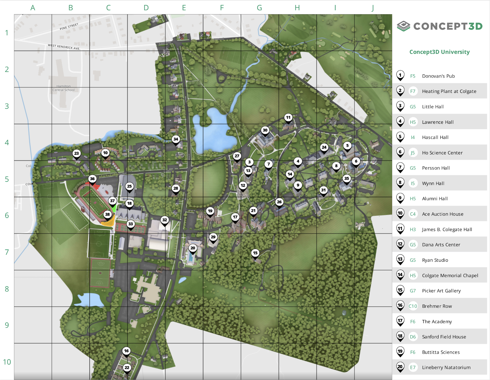
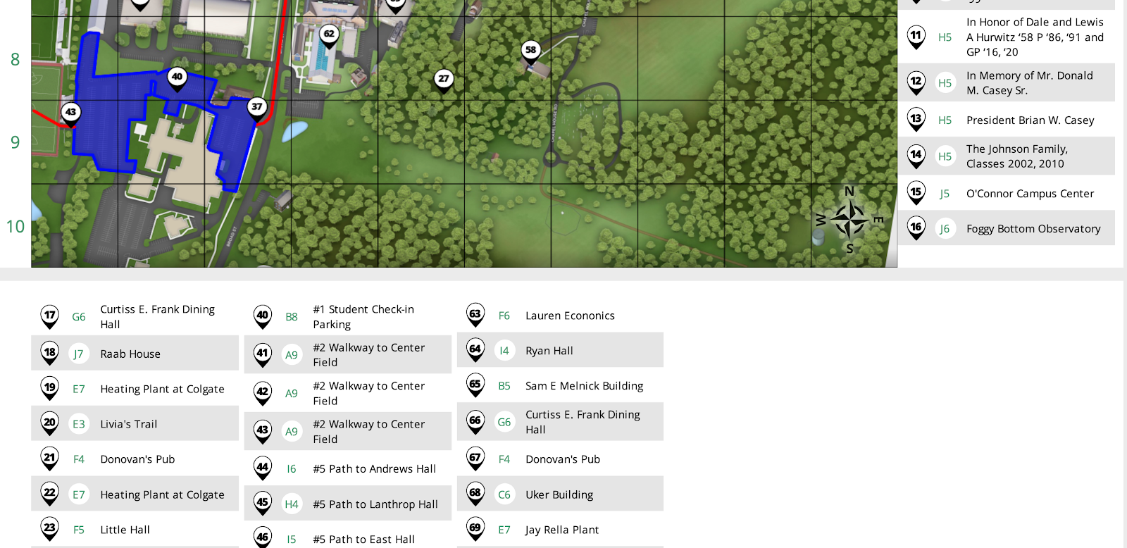
The new look and layout of Print Map 3.0. Notice the clearer grid, title, and legend.
Numbered icons have been updated stylistically in Print Map 3.0.
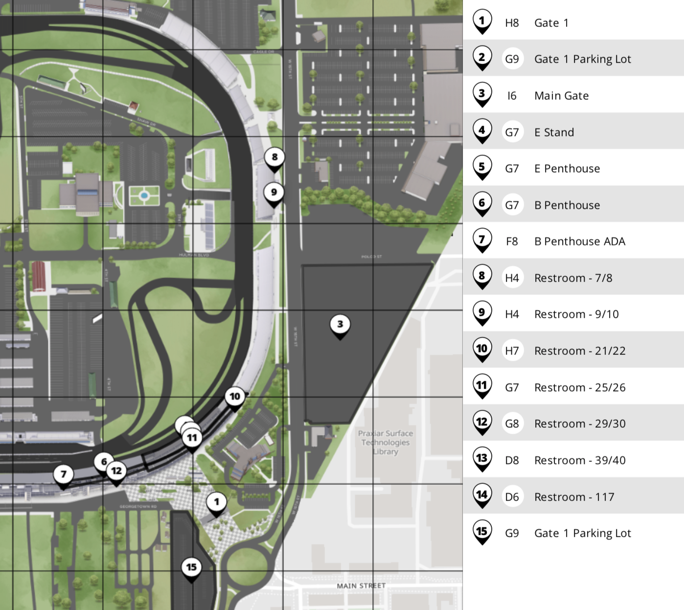
The legend now overflows onto the next page in a condensed version.